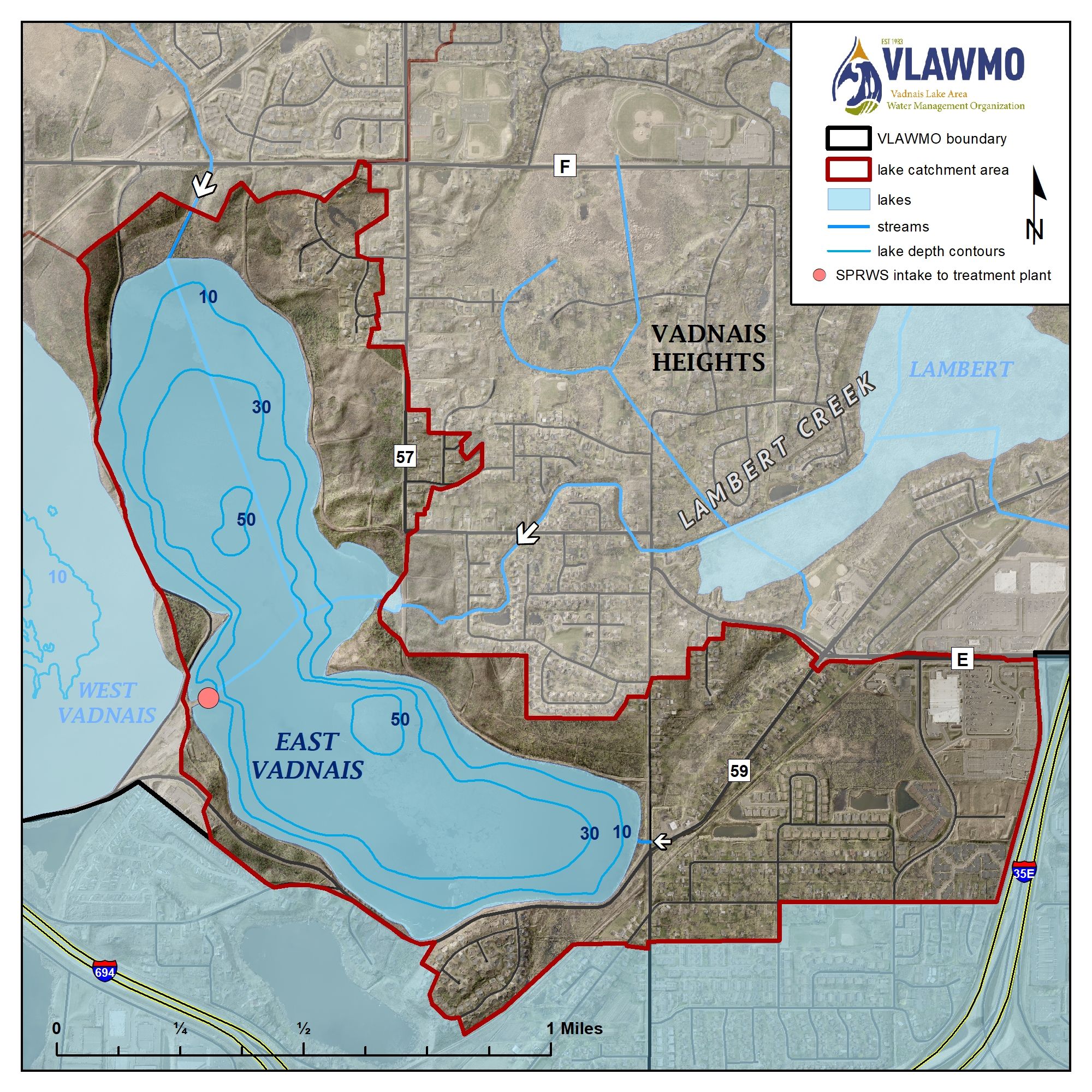
East Vadnais Lake is the final reservoir for the Saint Paul Regional Water Services (SPRWS). Surface water enters East Vadnais Lake from the Mississippi River through a chain of lakes (Charley, Pleasant, Sucker, East Vadnais) as well as Lambert Creek. Surface water outlets to the SPRWS water treatment facility, to be dispersed to about 450,000 customers in Saint Paul and surrounding communities. East Vadnais Lake is a protected lake within the Vadnais-Sucker Lakes Regional Park with recreational trails and designated shoreline access for fishing. It has no watercraft access for both motorized and non-motorized boats.
East Vadnais and West Vadnais Lakes are separate waterbodies. While a historic surface water connection may have existed at one time, studies as recent as 2018 indicate that there is no underground connection between them. More information on West Vadnais Lake is also available below.
Surface Area
389 acres
Average Depth
30 ft
Maximum Depth
58 ft
Catchment Area
889 acres
Location
Vadnais Heights